Description
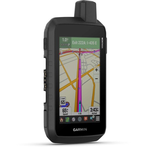
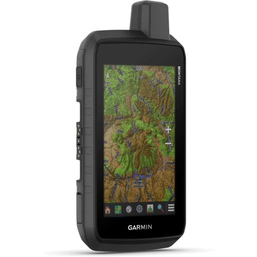
Garmin Montana 710i Handheld Navigation Device
Robust handset with touch display and inReach® technology
Advanced outdoor features and inReach technology for two-way messaging and interactive SOS emergency calls are integrated into a rugged 5-inch format. The handheld is ideal for navigation on foot, by bike, kayak, off-road vehicle and more.
Highlights of the Garmin Montana® 710i
- 5-inch touch display that can be operated with gloves
- Pre-installed routable topographic maps with landmarks
- Always connected with inReach messages and 24/7 SOS functions
- Complies with MIL-STD 810 in terms of thermal performance, shock resistance, water resistance and vibration
- Satellite imagery for aerial views of the route
- Supports Outdoor Maps+ for premium maps (sold separately)
- Plan and view routes with the Garmin Explore™ app
Details about Garmin Montana® 710i
- Worldwide accessibility: With an active inReach subscription, you can stay connected even on adventures in remote areas. Instead of relying on cellular coverage, your messages, SOS distress calls and locations are transmitted via the Iridium® satellite network with 100% global coverage.
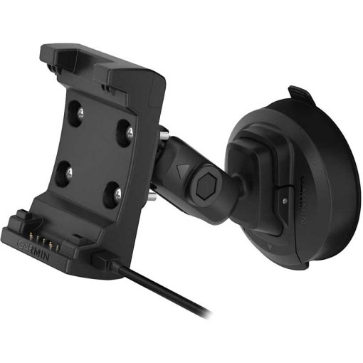
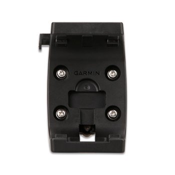
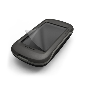
- Exclusive design: This rugged, water-resistant handset meets MIL-STD 810 for thermal performance, shock resistance, water resistance and vibration. It has a 5-inch gloved touch display and supports multiple rugged mounting options (sold separately) to accommodate all activities.
- TopoActive maps: Use preloaded topographic maps to navigate your adventures. View terrain contours, elevation data, coastlines, rivers, landmarks and more.
- Detailed satellite images: Download high-resolution satellite images directly to your device via Wi-Fi - no subscription required. View photorealistic aerial views of routes and surrounding terrain and easily create waypoints based on landmarks.
- Outdoor Maps+: Purchase a subscription to Outdoor Maps+ (sold separately) to access a wide range of premium map content and receive regular updates sent directly to your handset via Wi-Fi.
- Garmin Explore™ app: Pair the handheld with the Garmin Explore app to plan trips, view trip data and also manage waypoints, routes and activities.
- Two-way communication: Exchange SMS messages with your loved ones at home or communicate with other inReach devices in the field using the inReach device.
- Inactive SOS emergency call: In an emergency, send an interactive SOS emergency call to Garmin Response℠, a 24/7 emergency coordination center.
- inReach weather information: The available inReach weather service delivers detailed updates directly to your Montana or paired devices so you know what the weather conditions are like on the road.
- LiveTrack : Via your LiveTrack page, followers can view your progress, send a request to your device to see your GPS position and exchange messages during your ride.
- Multi-frequency reception: Thanks to multi-frequency reception, the Montana 710i ensures precise positioning even in more difficult environments compared to using GPS alone.
- ABCsensors: With ABC sensors, including an altimeter for altitude data, a barometer for monitoring the weather and an electronic 3-axis compass, you can navigate reliably in the terrain.
- City Navigator® maps: Switch seamlessly between trail and road navigation with European City Navigator maps. The easy-to-follow turn-by-turn directions support you during your ride.
- Additional maps: Use the 32 GB internal memory to download additional maps, such as BlueChart® g3 maps for navigation on the water (sold separately).
- Customized weather data: Access up-to-date, active weather forecasts via the Garmin Connect™ app on your compatible smartphone.
- Perfect dog tracking: For hunting and training, the Montana syncs with compatible Astro® or Alpha® series handsets to track sporting dogs in the field.
- Wikiloc Trails: This app allows you to download hiking and biking trails as well as other Wikiloc trails shared by other outdoor enthusiasts like you. Get a free 60-day Wikiloc Premium trial to test these and other exclusive features.
- Expedition mode: Cover long distances in the field. Use Expedition Mode, an ultra-low power GPS reference mode, to use the Montana for more than 2 weeks before it needs to be recharged.
- Extend battery life with batteries: An integrated lithium-ion battery pack delivers up to 24 hours of runtime in GPS mode and recharges with a standard USB-C® cable.
- Mount for boats, motorcycles and more: With a variety of mounts compatible with the Montana (sold separately), you can use the navigator with off-road vehicles, boats, cars, motorcycles, RVs or other vehicles.
Technical data of the Garmin Montana® 710i
- Watch glass material: Chemically reinforced glass
- Dimensions: 9.19 x 18.30 x 3.27 cm
- Weight: 410 g with lithium-ion battery pack from the scope of delivery
- Water resistance: IPX7
- MIL-STD-810: thermal performance, shock resistance, water resistance, vibration
- Display: Transflective WVGA display with selectable orientation, touchscreen, display size: 6.48 x 10.80 cm, 12.70 cm (5-inch) diagonal, resolution: 480 x 800 pixels
- Battery: Rechargeable lithium-ion battery (included)
- Battery life:
- GPS mode: Up to 24 hours (including when sending an SMS message or position every 10 minutes)
- Expedition mode: Up to 440 hours or up to 300 hours when sending an SMS message or position every 30 minutes
- Switched off: Up to 1 year
- Memory/log: 32 GB (the amount of memory available to users depends on the integrated maps)
- Interface: Compatible with high-speed USB-C and NMEA 0183
- Pre-installed maps: TopoActive Europe - additional regions can be downloaded via WLAN
- Options for adding maps
- Automatic route guidance (turn-by-turn directions on roads)
- Map segments: 15,000
- BirdsEye: directly on the device
- Includes detailed hydrographic features: Shorelines, shorelines of lakes/rivers, wetlands and permanent and seasonal watercourses
- Includes searchable points of interest: parks, campgrounds, overlooks and picnic areas
- National, state and local parks, forests and natural areas
- Storage and performance capacity: microSD™ card with a maximum of 32 GB
- Waypoints: 10,000
- Tracks: 250
- Track recording: 20,000 points, 250 saved GPX tracks, 300 saved FIT activities
- Routes: 250, 250 points per route; 50 points for automatic route calculation
- Rinex recording
- Sensors: GPS, Galileo, barometric altimeter, compass (3 axes, tilt correction), high-sensitivity GPS receiver, GPS compass (when in motion)
- Wireless connectivity: WLAN, Bluetooth®, ANT+®
Daily smart functions
- Connect IQ™ (downloadable display designs, data fields, widgets and apps)
- Smart notifications on the handset
- Weather
- Active weather data
- Compatible with Garmin Messenger app
- VIRB® remote control
- Compatible with Garmin Connect™ Mobile
Safety and tracking features
- LiveTrack
Tactical functions
- XERO™ locations
- Ballistics calculator
Outdoor leisure functions
- Point-to-point navigation
- TracBack®
- Area calculation
- Fishing forecast
- Sun and moon calendar
- Geocaching mode: Geocaching Live
- Compatible with custom maps: 500 user-defined map tiles
- Image viewer
- LED locator light
inReach® functions
- Interactive SOS emergency calls
- inReach weather
- Message exchange (sending and receiving) via SMS and email
- SMS message exchange (sending and receiving) via another inReach device
- Sending and receiving group messages
- Exchange locations with other inReach device
- Compatible with MapShare with tracking
- Virtual keyboard for composing your own messages
- Sending waypoints to MapShare while traveling
- Sending route selection to MapShare while traveling
Outdoor applications
- Compatible with the Garmin Explore ™ app
- Compatible with the Garmin Explore website
- Smart switching between Wi-Fi, cellular and satellite with the Garmin Messenger app
- Dog tracking: when paired with a compatible dog tracking system
Scope of delivery
- Montana® 710i
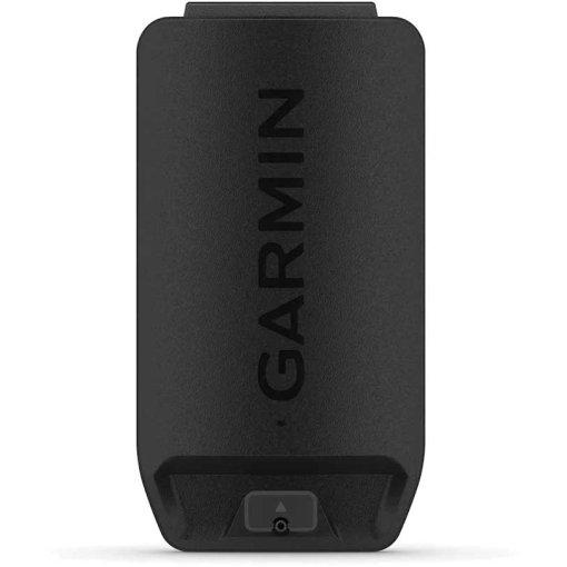
- High-capacity lithium-ion battery pack
- Charging/data cable (USB-C to USB-C)
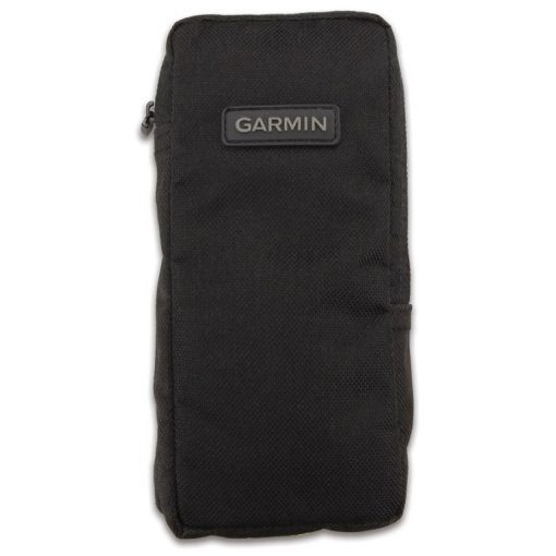
- documentation

Fact Sheet
| Product Name: | Garmin Montana 710i Handheld Navigation Device |
| Manufacturer: | Garmin |
| Item Code: | GAR717767 |
| activity: | Cycling, Outdoor, Hiking |
| dimensions (l/w/h): | 92/183/33mm |
| IP rating: | IPX7 |
| transmission standard: | ANT+, Bluetooth, WiFi, USB, Wireless |
| expandable memory: | yes |
| internal memory: | 32Gb |
| Battery Type: | Custom Li-Ion/LiPo Pack |
| device functions: | Altitude, GPS, Navigation, HRM optional, Cadence (optional or included), Temperature, Smart Notifications |
| Device Version: | Handheld |
| compass type: | electronical |
| Display Features: | Colored, Touchscreen, with Map Display |
| display size (diagonal): | 5" |
| Model year: | 2026 |
| Collection: | Full year |
| Color: | Black |
| weight: | 410g |
| manufacturer item code: | 010-02964-01 |
| Weight Source: | Manufacturer |
| GTINs: | 753759336899 |
| Manufacturer page: | https://www.garmin.com |
Availability
Ratings (0)
Manufacturer
Garmin
All products from Garmin
Garmin Deutschland GmbH
Parkring 35
85748 Garching
Germany
+4989 858364880
Parkring 35
85748 Garching
Germany
+4989 858364880