Description
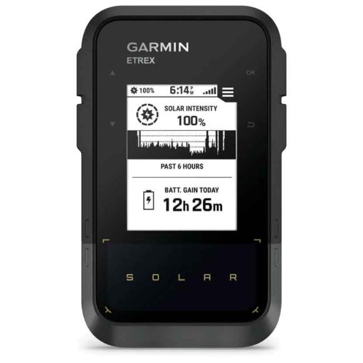
Garmin eTrex Touch GPS Handheld Navigation Device + Topo Active Europe Map - 010-02940-01
GPS handheld device with touch display and pre-installed maps
The robust handheld GPS device was specially developed for outdoor adventures and extreme weather conditions. Thanks to the long battery life, you can enjoy your activities even more.
Highlights of the Garmin eTrex Touch
- Swipe and zoom on a bright 3 inch touch display
- Pre-installed Europe maps for roads and trails
- Lengthy battery life of up to 130 hours in GPS mode
- Plan and view tours with the Garmin Explore™ app
- Rugged (MIL-STD 810) and water-resistant (IP67)
- Optional purchase of an Outdoor Maps+ subscription for premium maps
Details about Garmin eTrex Touch
- Touch display: The slim and lightweight pocket-sized handheld device has a bright and colorful 3 inch touch display. It allows you to zoom in on maps, swipe across the display and follow routes.
- Robust design: The eTrex Touch is specially designed for use in extreme weather conditions and demanding circumstances (waterproof according to IP67 and MIL-STD-810). It has a completely redesigned user interface that allows you a more intuitive and user-friendly operation.
- Navigation: Navigate with pre-installed TopoActive maps for Europe - as well as easily accessible global maps. For example, view terrain contours, elevations, coastlines, rivers, landmarks and POIs.
- Outdoor Maps+: A subscription to Outdoor Maps+ gives you access to premium maps available worldwide, including roads and trails, points of interest, contour lines and more. An active subscription is required to receive regular updates via Wi-Fi.
- Route planning: Plan your trip, view your track on a map, save an activity and view a route marker indicating how far it is to your destination. This requires pairing with the Garmin Explore app on your compatible smartphone.
- Real-time weather information: Monitor the weather and make informed decisions during your activity based on weather radar and wind direction data from weather stations when your smartphone is paired.
- Battery life: In all-satellite and multi-frequency mode, the eTrex Touch offers a battery life of up to 130 hours (with SatIQ™ technology) and up to 650 hours in expedition mode.
- GPS accuracy: The integrated antenna automatically acquires satellite signals to update the width and longitude of your position.
- Discover new routes: Your eTrex Touch searches for the best route. Enter the desired distance and receive route suggestions for circular tours.
- Ascent planning: Get information about upcoming ascents on your route, e.g. when they will occur and how steep they will be.
- Digital compass: Follow your route with the digital compass. The compass provides precise information even when you are not moving.
- Geocaching: Receive automatic cache updates, including descriptions, logs and hints, when your handheld is paired with the Garmin Explore app, so each of your geocaches is uploaded to your geocaching.com profile.
- Garmin Share: Quickly and easily share your planned routes and waypoints with other compatible Garmin products.
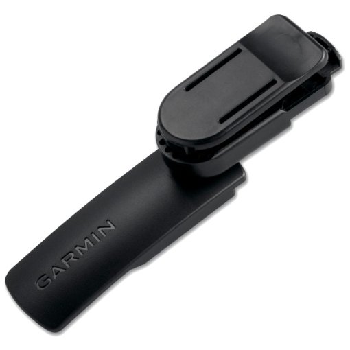
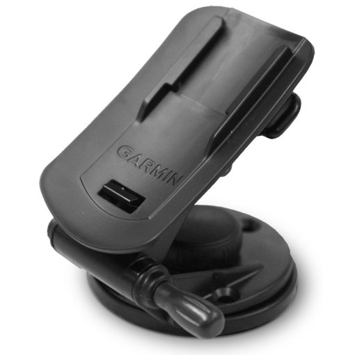
- Mounts: For more versatility on your adventures, separately available mounts allow you to attach your handheld device to your backpack or bike.
Technical data of the Garmin eTrex Touch
General features
- Material: Chemically reinforced glass
- Dimensions: 66 mm x 105.4 mm x 24.6 mm (2.6-inch x 4.15-inch x 0.97-inch)
- Weight: 150 g
- Waterproof: IP67
- Touch screen
- Display type: 3-inch transflective TFT color display, 3.88 cm x 6.48 cm (1.53-inch x 2.55-inch); 7.62 cm (3-inch) diagonal
- Display resolution: 240 x 400 pixels
- Rechargeable battery: Integrated lithium-ion battery
- Battery life: All satellite systems + multiband: Up to 130 hours, expedition mode: Up to 650 hours (assuming normal use with SatIQ technology)
- Memory: 32 GB (the amount of memory available for users depends on the integrated maps)
- Interface: USB-C
Maps and spokes
- Pre-installed maps: TopoActive, routable
- Possibility to add maps
- Base map
- Automatic route guidance (turn-by-turn directions on roads)
- Map segments: 15,000
- Satellite images: via Outdoor Maps+ subscriptions
- Includes detailed hydrographic features (shorelines, lake/river shorelines, wetlands and permanent and seasonal watercourses)
- Includes searchable points of interest (parks, campgrounds, overlooks and picnic areas)
- National, state and local parks, forests and natural areas
- Waypoints
- Trails: unlimited
- Activities: unlimited
- Activity profiles
- GPX imports
sensors
- GPS AND
- GLONASS
- GALILEO
- QZSS
- BEIDOU
- IRNSS
- Barometric altimeter
- Compass
- High-sensitivity GPS receiver
- GPS compass (when in motion)
- Multi-band frequencies
Daily smart functions
- Connect IQ™ (downloadable display designs, data fields and apps)
- Smart notifications on the handset
- Real-time weather information
- Compatible with Garmin Connect™ Mobile
- Garmin Share
- Password
- Next word, autocomplete, autocorrect
Security and tracking functions
- LiveTrack
Tactical functions
- Compatible with AB Synapse
- Ballistic calculator: activation required
- Dual grid coordinates
- Night vision mode
Outdoor recreational functions
- Point-to-point navigation
- TracBack®
- Area calculation
- Sun and moon calendar
- Geocaching mode: Geocaching Live
- Compatible with Custum Maps: 500 user-defined map tiles
- Image viewer
Outdoor applications
- Compatible with the Garmin Explore™ app
- Compatible with the Garmin Explore website
Connectivity
- Wireless connectivity: Wi-Fi®, BLE, ANT®
Scope of delivery
- eTrex Touch handheld GPS device
- USB cable - type C to type C
- documentation

Fact Sheet
| Product Name: | Garmin eTrex Touch GPS Handheld Navigation Device + Topo Active Europe Map - 010-02940-01 |
| Manufacturer: | Garmin |
| Item Code: | GAR745766 |
| activity: | Cycling, Outdoor, Hiking |
| dimensions (l/w/h): | 66/106/25mm |
| IP rating: | IP67 |
| transmission standard: | ANT+, Bluetooth, WiFi, USB, Wireless |
| expandable memory: | no |
| internal memory: | 32Gb |
| Battery Type: | integrated Battery |
| device functions: | Altitude, GPS, Navigation, Temperature, Smart Notifications |
| Device Version: | Handheld |
| compass type: | electronical |
| Display Features: | Colored, Touchscreen, with Map Display |
| display size (diagonal): | 3" |
| Model year: | 2026 |
| weight: | 150g |
| manufacturer item code: | 010-02940-01 |
| Weight Source: | Manufacturer |
| GTINs: | 753759346843 |
| Manufacturer page: | https://www.garmin.com |
Availability
Ratings (0)
Manufacturer
Garmin
All products from Garmin
Garmin Deutschland GmbH
Parkring 35
85748 Garching
Germany
+4989 858364880
Parkring 35
85748 Garching
Germany
+4989 858364880